The Recent Weather Events in Himachal
Recent development on Indian Climate and Monsoon. Review source articles.
- •Himachal Thunderstorms and Nationwide Heat Wave: What the Weather Data Reveal
Himachal Thunderstorms and Nationwide Heat Wave: What the Weather Data Reveal
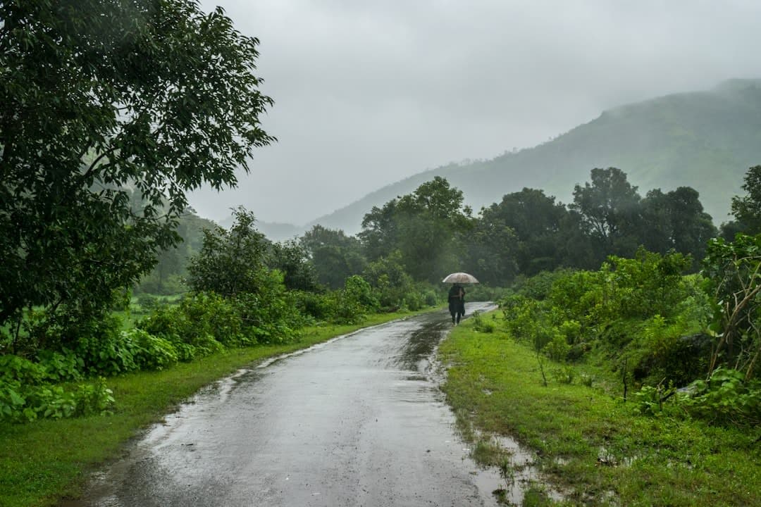
The Himachal Pradesh Met office issued a yellow warning on June 22, reporting thunderstorms that drenched Jot with 22.8 mm of rain, followed by significant falls at Slaper (14.3 mm) and Dhaulakuan (9 mm). Simultaneously, the India Meteorological Department (IMD) warned of very‑heavy rainfall persisting over northeast India until June 25 and a heat‑wave spreading across Vidarbha, eastern Madhya Pradesh and Uttar Pradesh for the next five days.
The sudden downpours in the sub‑Himalayan districts of Kangra, Shimla and Kullu underscore the region’s vulnerability to fast‑moving convective systems. The yellow alert covers isolated thunderstorms, lightning and gusts of 30‑40 km ph, expected to linger until Friday, June 26.
- ▸Jot recorded 22.8 mm of rain, the highest in the state for the day.
- ▸Slaper and Dhaulakuan received 14.3 mm and 9 mm respectively.
- ▸Sundernagar, Sangla, Manali and Shimla each logged between 3 mm and 5 mm.
- ▸The warning also flags gusty winds of up to 40 km ph in isolated pockets.
Why the Himalayas Get Sudden Showers
The precipitation pattern is driven by Western Disturbance, a mid‑latitude trough that slides southward from the Mediterranean, colliding with the Himalayan barrier. As moist air is forced up the steep slopes, it cools adiabatically, condensing into convective clouds that can produce intense, short‑lived rainfalls even in June.
- ▸Western Disturbances typically arrive between December and March, but late‑season incursions are becoming more frequent.
- ▸The orographic lift over elevations above 1,500 m amplifies rainfall intensity, often exceeding 20 mm in under an hour.
- ▸Interaction with the nascent Southwest Monsoon can enhance instability, leading to thunderstorms rather than the gentle drizzles of earlier months.
The Broader Monsoon Outlook and Heat‑Wave Threat
While the Himalayas wrestle with sporadic storms, the rest of the country braces for a delayed Monsoon Onset. IMD’s criteria—persistent low‑level wind convergence, sea‑surface temperatures above 28 °C and a marked rise in humidity—have not yet aligned over the central Indian coast. Consequently, Mumbai’s monsoon arrival is projected for June 22‑23, later than the climatological average of June 1.
- ▸Heavy to extremely heavy rain is forecast for northeast India until June 25, and for West Bengal and Sikkim until June 22.
- ▸Heat‑wave conditions are expected over Vidarbha, East Madhya Pradesh, East Uttar Pradesh, Chhattisgarh, Telangana, Maharashtra’s Marathwada and Madhya regions for the next three‑to‑five days.
- ▸Isolated thunderstorms with gusts up to 60 km ph are also predicted for the Konkan coast and Goa between June 22‑25.
Did You Know? The Himalayas act as a “water tower” for India, feeding major river basins such as the Ganga and Brahmaputra; a single 10 mm rain event in the upper catchments can translate into millions of cubic metres of runoff downstream.
Implications for Water Management and Disaster Preparedness
Uttar Pradesh’s Chief Minister Yogi Adityanath has urged every resident to engage in water‑harvesting, citing the IMD long‑range forecast of below‑normal monsoon rainfall for the state. The directive aligns with the National Water Mission, which seeks to augment water‑use efficiency and promote decentralized storage. Moreover, the warning underscores the need to integrate disaster risk reduction measures prescribed by the Sendai Framework for Disaster Risk Reduction.
- ▸State officials are to coordinate irrigation, groundwater, and the Namami Gange programme for an integrated action plan.
- ▸Public participation is emphasized to prevent contamination of ponds and “Amrit Sarovars” (sacred water bodies).
- ▸The IMD’s warning system, operated by the India Meteorological Department, provides real‑time alerts that can trigger pre‑emptive evacuations and infrastructure safeguards.
Looking Ahead: Climate Change and Future Risks
Long‑term climate projections suggest an intensification of both monsoon variability and extreme heat events. Warmer sea‑surface temperatures amplify moisture availability, while altered jet‑stream patterns increase the frequency of late‑season Western Disturbances. These trends raise the stakes for adaptive water‑resource planning, especially in trans‑boundary river basins that feed downstream states and neighboring countries.
- ▸Climate models project a 5‑10 % rise in extreme rainfall events over the Himalayas by 2050.
- ▸Heat‑wave days in central India could increase by up to three days per year under a 2 °C warming scenario.
- ▸Strengthening of early‑warning systems and community‑based water conservation will be pivotal to mitigate socioeconomic disruptions.
Tags
Concepts Mentioned
Indian Meteorological Department
The Indian Meteorological Department (IMD) is the national weather forecasting agency of India, responsible for monitoring and predicting weather conditions across the country. It plays a crucial role in disaster management, agriculture, and aviation by providing accurate weather forecasts and warnings. The IMD issues the India Meteorological Department's Cyclone Warning Centre, which issues cyclone warnings for the eastern coast of India.
Sendai Framework for Disaster Risk Reduction
The Sendai Framework is a global plan for disaster risk reduction, aiming to reduce disaster losses. It is significant for promoting resilience and sustainability. Adopted in 2015, it has seven targets.
National Solar Mission
The National Solar Mission is India's initiative to promote solar energy. It aims to reduce dependence on fossil fuels. Launched in 2010, it targets 100 GW of solar power capacity.
Monsoon Onset
Monsoon onset is the first measurable rise in rainfall that signals the start of the seasonal monsoon, typically marked by a sustained shift in wind direction and increased humidity. It is crucial for agriculture, water resources, and disaster preparedness across South and Southeast Asia. For example, in India the southwest monsoon usually begins over Kerala around June 1st.
South West Monsoon
The South West Monsoon is a seasonal weather pattern that brings significant rainfall to parts of India and Southeast Asia. It is crucial for agriculture and water supply in these regions, with the monsoon rains replenishing reservoirs and irrigating crops. For instance, the South West Monsoon accounts for over 70% of India's annual rainfall.
Western Disturbance
Western Disturbance is a weather phenomenon bringing winter rain to India. It is significant for agriculture and water supply. It originates over the Mediterranean Sea.
Log in to like, comment, and join the discussion.